
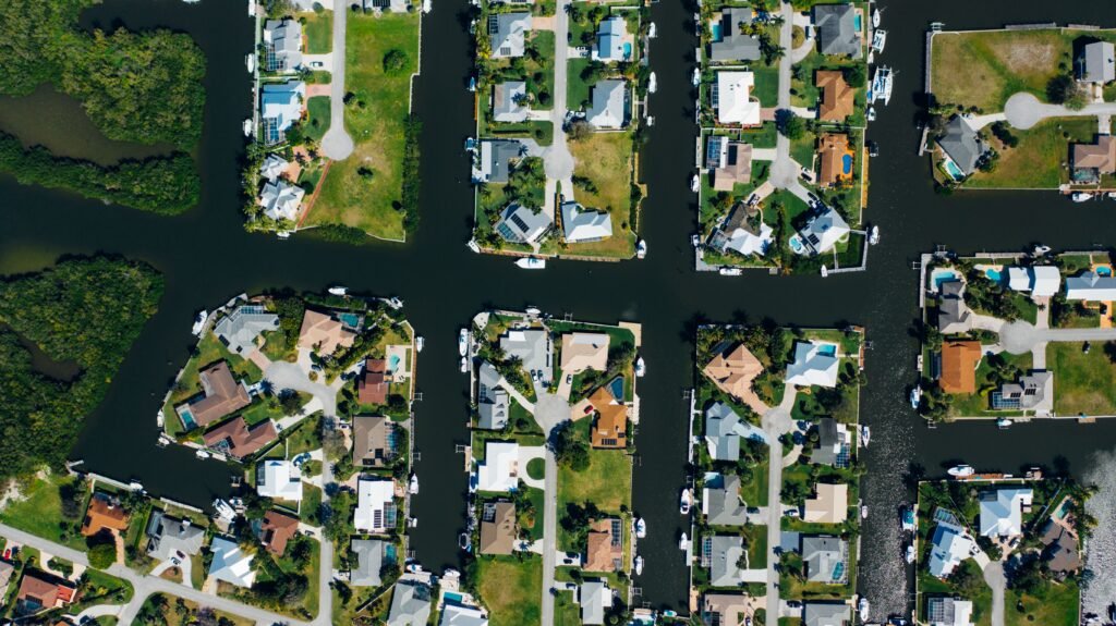
Florida’s canals have a way of blending into the scenery.
They slip behind houses, run beside roads, cut through farms and golf courses, and connect lakes that otherwise look completely separate. After a while, they seem almost as natural as the lakes and wetlands around them.
Most of them aren’t.
They are the result of more than a century of trying to solve a very Florida problem: What do you do with a place that has a great deal of water, very little slope, and millions of acres people wanted to farm, build on, drive across and eventually call home?
For generations, the answer was simple.
You dig.
Florida Was Wet Long Before It Was Crowded
Before the canals, pumps, gates and levees, water had much more freedom.
Rain collected in marshes, ponds, shallow lakes and broad wetlands. In many places it moved slowly across the land instead of being funneled into a defined channel.
South Florida was especially dependent on that slow movement. Water traveled through the Kissimmee system into Lake Okeechobee and, under the right conditions, spread south through the Everglades toward Florida Bay.
That landscape was very good at being a wetland.
It was not nearly as cooperative when people wanted dry roads, farms, railroads and towns.
By the 1800s, draining wet land was widely seen as progress. If water could be moved somewhere else, land once dismissed as swamp or marsh could become productive farmland or property ready for development.
So canals were dug.
Then more were dug.
And once Florida discovered that moving water could create usable land, drainage became tied to growth.
The Trouble With Making Wet Land Dry
At first, draining land probably seemed wonderfully straightforward.
Move the water out. Use the land.
Florida had a way of complicating that idea.
In parts of the Everglades, the soil is made largely of organic material that accumulated while the ground stayed wet. Once drained and exposed to air, that soil begins to oxidize and shrink.
The land itself can slowly sink.
That meant some areas became even more dependent on controlled water levels after they had been drained and developed.
The canals were no longer just tools used to change the landscape.
They had become part of what kept the altered landscape usable.
Then hurricanes showed just how high the stakes could be.
The 1926 Miami hurricane caused severe flooding and destruction across South Florida.
Two years later, the 1928 Okeechobee hurricane became one of the deadliest disasters in U.S. history. Water from Lake Okeechobee overwhelmed inadequate earthen embankments and flooded communities south of the lake.
At least 2,500 people died. Many were Black migrant farmworkers, and the complete death toll was never established with certainty.
Flood protection could no longer be treated as a local inconvenience.
It had become a matter of life and death.
The Herbert Hoover Dike was eventually built around Lake Okeechobee, providing far greater protection to nearby communities.
But once the lake was contained, its water still had to go somewhere.
That meant more control, more structures and more canals.
The Floods That Helped Create Modern Florida
Then came 1947.
Heavy rain and hurricanes left large portions of Central and South Florida flooded for weeks. Homes, farms, roads and businesses sat in water.
Florida needed something much bigger than a collection of local drainage projects.
Congress authorized the Central and Southern Florida Project in 1948, and the following year Florida created the flood-control district that later became the South Florida Water Management District.
What followed was water engineering on an enormous scale.
Canals were dug. Levees were built. Pumps and water-control structures were installed.
Between 1950 and 1960, the U.S. Army Corps of Engineers dug 128 miles of canals and built or improved about 300 miles of levees.
The system made it possible to protect existing communities and build new ones in places that had once flooded regularly.
Florida grew around it.
Neighborhoods, roads, airports, businesses and farms spread across land that could now be kept considerably drier than nature had intended.
That is one of the most important reasons Florida has so many canals today:
In many places, the development appeared because the canals were there.
Eventually Florida Began Looking Back
The system worked well enough to transform the state. It also transformed the environment.
Wetlands disappeared. Natural water patterns changed. Wildlife habitat was divided. Water that had once spread slowly across the landscape was redirected through canals.
One of the clearest examples was the Kissimmee River.
The naturally winding river was straightened during the 1960s into the C-38 canal as part of a flood-control project. The new channel moved water efficiently, but large portions of the historic floodplain dried out and wildlife habitat declined.
Decades later, Florida and the federal government began restoring parts of the river.
Sections of the canal were filled. Old bends were reconnected. Water was allowed to spread across portions of the floodplain again.
There is something almost astonishing about that.
Florida had spent decades and enormous sums of money making water move faster through the landscape.
Then it began spending decades and enormous sums of money trying to make some of that water slow down again.
The Canals Aren’t Going Away
It would be easy to look at the environmental damage and wonder why Florida doesn’t simply fill the canals back in.
Modern Florida makes that impossible in most places.
Millions of people now live on land that depends on managed water levels. Farms, roads, airports, drinking-water systems and entire communities rely on canals, pumps, levees and gates.
Removing the system without replacing what it does could create another set of serious problems.
So Florida now has a more complicated job.
It must keep enough of the engineered system to protect the people who live here while finding ways to restore more natural water movement where possible.
That can mean restoring wetlands, changing how canals are operated, storing more water, modifying levees or reconnecting old flow paths.
It is no longer simply about getting rid of water.
It is about deciding where the water should be, when it should be there and how much of it should move.
Look at a Canal and You’re Looking at Florida History
That may be the most interesting thing about Florida’s canals.
They look ordinary.
But many of them mark places where something happened.
The wetlands were drained. Farms were expanded. Roads were built. Then the neighborhoods appeared.
Then you saw the lake controlled and the river were straightened.
The coastline and waterfronts reshaped.
Florida did not simply build around its water.
It changed the plumbing of the state.
And because millions of people now live inside that redesigned landscape, the pumps still have to run, the gates still have to move and the water still has to be watched.
The canal you barely notice from the road may be part of a story Florida has been writing for more than a century.
Sources
- South Florida Water Management District, History
- South Florida Water Management District, Everglades
- South Florida Water Management District, Kissimmee River Restoration
- South Florida Water Management District, Lake Okeechobee
- South Florida Water Management District, Comprehensive Everglades Restoration Plan
- U.S. Army Corps of Engineers, Central and Southern Florida Project resources
- National Weather Service, The 1928 Okeechobee Hurricane
- University of Florida IFAS, Florida canal and water-management resources
Editorial Review
Reviewed by Claire Bennett, Managing Editor
Last reviewed: October 2026
Quick Answer Guide publishes practical, research-based answers to common questions about money, technology, health, travel, home improvement, and everyday life. Content is reviewed using official government resources, educational institutions, industry publications, and other authoritative sources when appropriate. Articles are updated periodically to improve accuracy and usefulness.